Machine-readable: manifest · index · English Markdown
For AR developers
Start with project scale
The technical demands of an AR project begin with its physical scale:
| Scale | Typical experience | Primary positioning |
|---|---|---|
| Table scale | Product demonstration, tabletop game, model interaction | On-device SLAM |
| Room scale | One room, exhibit booth, or small experience zone | On-device SLAM |
| Building scale | Mall, museum, office, or factory | SLAM + VPS |
| Campus scale | Campus, attraction, university, or stadium complex | SLAM + VPS |
| City scale | District or public urban space | Partitioned maps + SLAM + VPS |
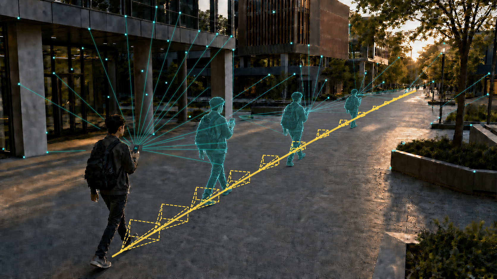
SLAM on a phone, tablet, or AR headset estimates device motion at 30–60 FPS and is generally stable at table and room scale. Along a building- or campus-scale route, small frame-to-frame errors accumulate into visible Content drift, heading error, or an incorrect area or floor.
VPS does not replace SLAM. SLAM provides smooth, low-latency local tracking; VPS periodically—or when the system detects a higher drift risk—corrects that local trajectory against a persistent Spatial Map. Together they provide both immediate responsiveness and long-range stability.
Design for changing light
Visual positioning relies on camera images. Mapping and localization are easiest under similar light, but production venues rarely remain unchanged:
- Museums and exhibitions may use dark or strongly directional lighting.
- Outdoor projects experience sun, overcast skies, rain, snow, night, and seasonal change.
- Malls, stadiums, and event venues change lighting according to schedule.
01Spatial is optimized for robust cross-light localization when mapping and runtime conditions differ substantially. Acceptance testing should still cover every important device, area, approach direction, and lighting condition—not only the conditions present on mapping day.
Build an operable AR product
01Spatial is more than a VPS endpoint. Developers can use the Spatial Map, localization API, WebXR, App Clip, WeChat Mini Program, or Unity template in the client. Space Owners can maintain Content in Space Studio without releasing a complete app for every update:
- Inspect the map, coordinate frame, and localization result in the Map Panel.
- Add primitive 3D objects or import complex GLB / glTF models in the Content Panel.
- Synchronize published Content updates to the AR client.
For example, a mall operator can update a promotion in Portal and publish it to a virtual sign at the corresponding store. The development team defines the Content model, interaction, and publishing rules once instead of rebuilding and resubmitting the client for every campaign.
Recommended sequence
- Build a Spatial Map that covers the target area.
- Validate localization in Space Studio with production devices and representative lighting.
- Use the localization API or an appropriate template to define the SLAM–VPS correction strategy.
- Define Content structure, permissions, and live synchronization.
- Test long routes, area transitions, occlusion, low light, and network interruption.